Back مقاطعة كولكويت (جورجيا) Arabic مقاطعة كولكيت، جورجيا ARZ Colquitt County, Georgia BAR Колкуит (окръг, Джорджия) Bulgarian কোলকুইট কাউন্টি, জর্জিয়া BPY Colquitt Gông (Georgia) CDO Колкуитт (гуо, Джорджи) CE Colquitt County CEB Colquitt County German Colquitt County, Georgia English
 | |
| Math | sir |
|---|---|
| Enwyd ar ôl | Walter T. Colquitt |
| Prifddinas | Moultrie |
| Poblogaeth | 45,898 |
| Sefydlwyd | |
| Daearyddiaeth | |
| Gwlad | |
| Arwynebedd | 1,441 km² |
| Talaith | Georgia |
| Yn ffinio gyda | Tift County, Thomas County, Brooks County, Cook County, Worth County, Mitchell County |
| Cyfesurynnau | 31.19°N 83.77°W |
 | |
Sir yn nhalaith Georgia, Unol Daleithiau America yw Colquitt County. Cafodd ei henwi ar ôl Walter T. Colquitt. Sefydlwyd Colquitt County, Georgia ym 1856 a sedd weinyddol y sir (a elwir weithiau'n 'dref sirol' neu'n 'brifddinas y sir') yw Moultrie.
Mae ganddi arwynebedd o 1,441 cilometr sgwâr. Allan o'r arwynebedd hwn, y canran o ffurfiau dyfrol, megis llynnoedd ac afonydd, yw 2.2% . Yn ôl cyfrifiad y wlad, poblogaeth y sir yw: 45,898 (1 Ebrill 2020)[1]. Mewn cymhariaeth, yn 2016 roedd poblogaeth Caerdydd yn 361,462 a Rhyl tua 26,000.[2]
Mae'n ffinio gyda Tift County, Thomas County, Brooks County, Cook County, Worth County, Mitchell County. Cedwir rhestr swyddogol o henebion ac adeiladau cofrestredig y sir yn: National Register of Historic Places listings in Colquitt County, Georgia.
 |
|
| Map o leoliad y sir o fewn Georgia |
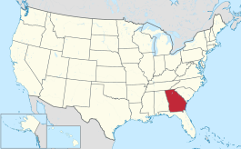
Lleoliad Georgia o fewn UDA |
- ↑ https://data.census.gov/cedsci/table?t=Populations%20and%20People&g=0100000US,%241600000&y=2020. Cyfrifiad yr Unol Daleithiau 2020. golygydd: Biwro Cyfrifiad yr Unol Daleithiau. dyddiad cyrchiad: 1 Ionawr 2022.
- ↑ statswales.gov.wales; adalwyd 25 Mawrth 2020.
